
Embrace The Brutality
What the hell?
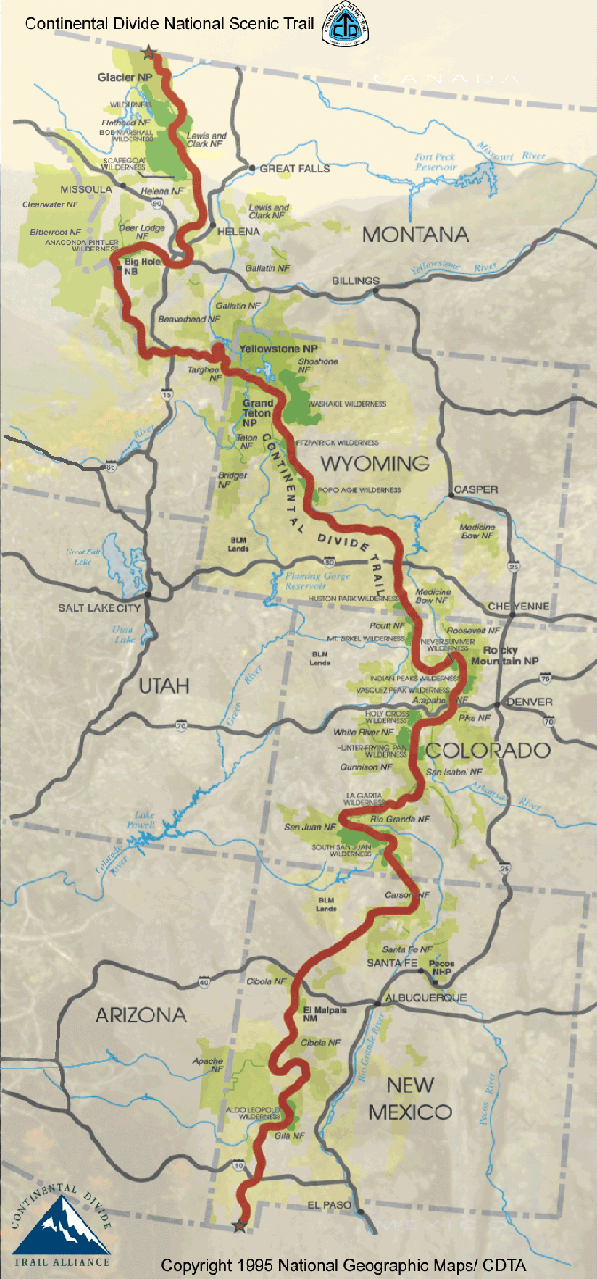
The Continental Divide Trail (CDT) is a National Scenic Trail running 3,100 miles (5,000 km) between Mexico and Canada.
It was established on November 10, 1978. It passes through 25 National Forests, 21 Wilderness Areas, 3 National Parks, 1 National Monument, and 8 BLM Resource Areas. It traverses five US states: New Mexico, Colorado, Wyoming, Idaho and Montana.
Cripes.
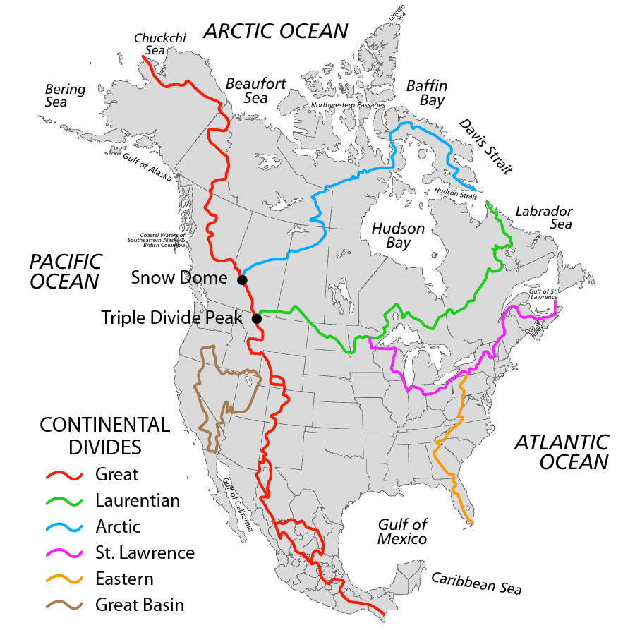
It receives its name from the ‘Great Continental Divide’ which separates the watershed draining into the Pacific from those draining into the Atlantic Ocean.
Where the hell?
The CDT begins it’ first 775 miles in New Mexico, heading north through dirty, gritty sweaty arid terrain.
Into Colorado, where it passes through some of Colorado’s highest and wildest terrain, reaming at high elevation for a lot of the trail. The CDT reaches it’s highest point in Colorado on Grays Peak- 4352m
Into Wyoming, for 550 miles. This is the state offering the most diversity in terrain as it includes the Wind River Range (possible highlight of the state) The Great Divide Basin and Yellowstone National Park.
For the next 980 miles the trail passes the border of Idaho and Montana, finishing in Montana’s Glacier National Park
The trail is usually completed between April and October. Late enough for an amount of snow to have melted making the San Juan Mountains in Colorado passable. Early enough before the deserts boil your blood and to finish before winter hits in the North.
Why the hell?
Hazzards:
- Avalanches
- Black bears
- Dehydration
- Falling
- Grizzly bears
- Hypothermia
- Landslides
- Lightning
- Mountain lions
- Severe weather
- Drowning
- Getting hit by a car – probably the most likely cause of deaths on most trails.
